Thirty-four giant turbines, together with foundations, roads, cables and drainage works, are proposed across protected peatland above Hebden Bridge. Before permission is granted, the public deserves proof that the scheme will not make the valley’s flood risk worse.
By Shane Oxer. Hope to Save Our Countryside
Hebden Bridge lies beneath the steep moorland catchments of the Upper Calder Valley.
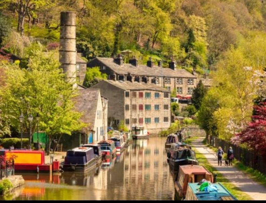
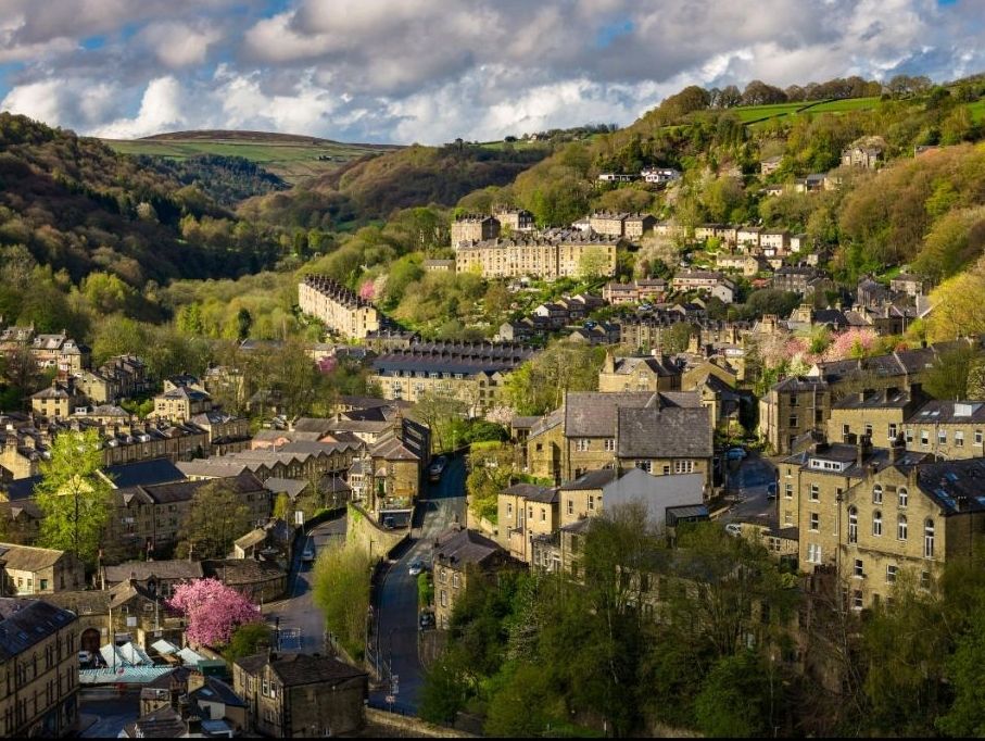
Photograph: David Dixon / Geograph, licensed under CC BY-SA 2.0.
Calderdale does not need lectures about flooding. Its residents know the sound of rising water, the ruined homes and businesses, the weeks of mud and disruption and the lasting anxiety every time heavy rain settles over the moors.
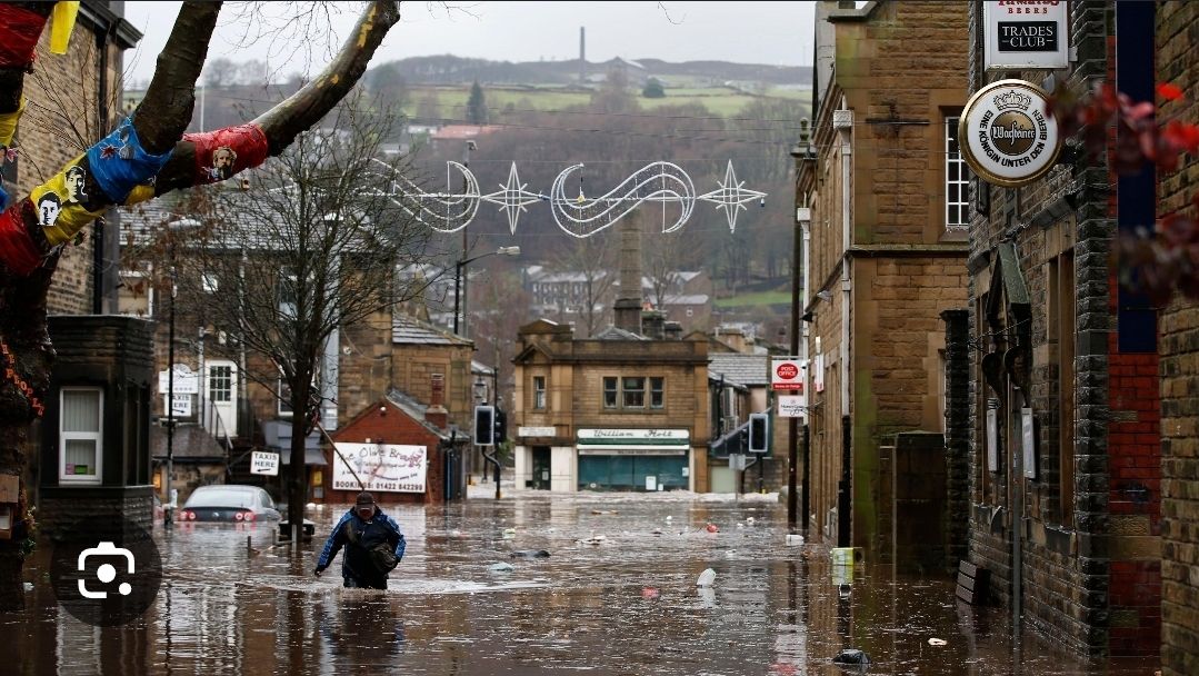
More than 3,000 properties across Calderdale were flooded on Boxing Day 2015. Storm Ciara brought another month’s worth of rain in 24 hours in February 2020, flooding about 1,200 properties and causing damage along ten miles of the valley.
Since 2012, Calderdale Council and its partners have secured £133 million for flood protection and resilience. That money is supporting strengthened defences, natural flood management, more resilient infrastructure and seven major schemes expected to provide better protection to more than 1,390 properties by 2027.
Against that background, one question should be impossible to avoid:
Why spend £133 million protecting Calderdale from flooding while permitting an industrial development that could disturb part of the natural system regulating water above the valley?
England’s biggest wind farm , on protected moorland
Calderdale Energy Park is proposed for Walshaw Moor, north of Hebden Bridge. The current design comprises 34 turbines of up to 200 metres, with an advertised generating capacity of approximately 240 megawatts. The developer says this is equivalent to the annual electricity use of around 198,000 homes.
But a wind farm is not simply a collection of slender towers placed gently on a hillside.
It requires large turbine foundations, extensive access tracks, crane hardstandings, underground cabling, drainage works, a substation and repeated movements of heavy construction traffic. Natural England says that, despite the reduction from the original 65 turbines, large amounts of this infrastructure would remain on deep peat.
That matters because Walshaw Moor is not empty or expendable land. Its turbine area is protected as a Special Area of Conservation, Special Protection Area and Site of Special Scientific Interest. Natural England describes the proposed site as an exceptional area for nature, with more than 1,000 hectares of irreplaceable blanket bog and more than 100 recorded bird species.
The peatland also performs a practical service for the communities below: it regulates water.
The moor is part of the flood-defence system
Flooding on Market Street, Hebden Bridge, after torrential rain in July 2006.
The Upper Calder Valley is steep and narrow. Rain falling on the surrounding uplands can reach its towns quickly, leaving residents with very little warning.
It is often said that peat simply acts as a giant sponge. The science is more precise than that. Flood protection depends on the peatland’s condition, vegetation, surface roughness, drainage and hydrology. Healthy or restored blanket bog can hold water in the landscape, slow storm flow and reduce or delay peak discharge. Damaged, drained or eroded peat can shed water more rapidly.
That is why the Environment Agency includes peat-bog restoration within natural flood management. It is also why the hydrological consequences of building roads, foundations, trenches and drainage across deep peat cannot be treated as a secondary detail.
No responsible campaigner should claim that every turbine foundation will automatically flood Hebden Bridge. But neither should a developer be allowed to assume that the risk can be designed away later.
The proper test is straightforward: before consent is granted, can the developer demonstrate through complete, independent and publicly scrutinised modelling that the entire development will not increase the speed, concentration or volume of damaging run-off reaching communities downstream?
At present, that case has not been made.
Even the developer acknowledges the potential risk
Calderdale Energy Park has acknowledged that construction activity and changes to run-off could potentially influence local flood risk. It says it is working with the Environment Agency to develop flood modelling and argues that peatland rewetting and habitat restoration could improve conditions in degraded areas.
Those promises must be tested against the full physical footprint of the development , not merely its turbine locations.
Restoration must not be used as a convenient accounting entry to excuse destruction elsewhere. Natural England is explicit that blanket bog takes thousands of years to form and cannot simply be recreated. Its June 2026 response says it does not expect effective compensation to be agreed for the scale and complexity of the proposed damage. It describes the unresolved issues as “likely to be insurmountable” in relation to the Habitats Regulations.
That is an extraordinary warning from the Government’s own statutory adviser on the natural environment. It cannot honestly be dismissed as ordinary local resistance to change.
The evidence has already been found wanting
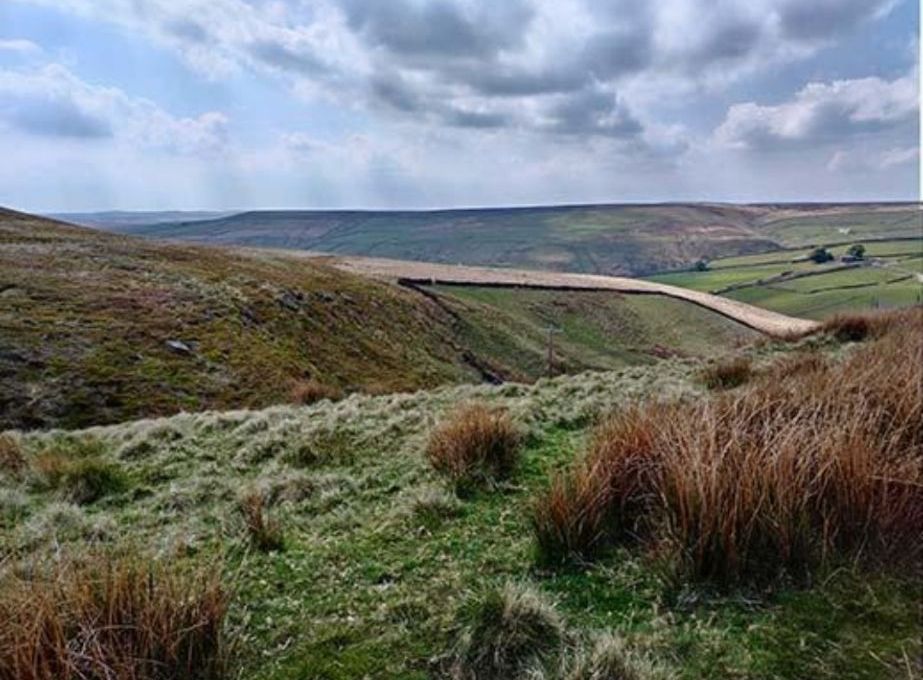
Walshaw Moor and the Walshaw Dean reservoirs above the Calder Valley.
Calderdale Council’s response to the statutory consultation identified significant errors, inconsistencies and omissions across the environmental information. It concluded that the consultation had not been conducted on an adequate evidential basis and called for the deficiencies to be addressed through a fresh process.
The Council highlighted incomplete baseline work and insufficient information about peatland, hydrology, watercourses and surface-water management. Natural England separately concluded that the proposed site is predominantly deep peat and that the overall impacts remain extremely high.
The developer’s published timetable anticipates submitting its Development Consent Order application in November 2026. A final decision would ultimately rest with the Secretary of State for Energy Security and Net Zero rather than the local council.
There must be no rush to meet a political timetable while fundamental environmental and public-safety questions remain unanswered.
The £133 million contradiction
Hebden Water swollen after torrential rain in October 2010. Photograph: Phil Champion / Geograph, licensed under CC BY-SA 2.0.
Calderdale’s flood programme recognises that hard defences alone are not enough. Public bodies are paying to strengthen walls and culverts while also restoring natural systems that slow water before it reaches the valley floor.
It would be perverse to invest £133 million in flood resilience and then gamble with protected peatland performing that same function upstream.
The developer may eventually produce modelling that it believes answers these concerns. That modelling must be independently examined, tested against the worst credible rainfall and construction scenarios, and consider the combined effects of every track, trench, foundation, hardstanding, culvert and drainage intervention across the site.
The burden of proof must rest with the developer. It must not be transferred to the families, shopkeepers and taxpayers of Calderdale after the damage has been done.
This is about more than a view
The turbines would transform internationally protected moorland and the landscape that inspired the Brontës. They could affect rare birds, tourism, local roads and the character of communities across West Yorkshire and Lancashire.
But the flood question cuts through every attempt to dismiss opposition as sentimentality or resistance to renewable energy.
This is about physical geography, public safety and financial risk. It is about whether ministers are prepared to protect a proven natural asset or sacrifice it to meet centrally imposed targets.
Calderdale has already paid a terrible price for flooding. Its residents should not be asked to carry an avoidable new risk so that another project can be counted towards a political target.
Before a single foundation is poured into Walshaw Moor, make them show the evidence.
Help us make Parliament confront the full consequences
Our petition calls for the Climate Change Act targets to be suspended while a full national impact assessment examines the real costs, infrastructure requirements and consequences for bills, industry, energy security and the countryside.
Sign and share the Parliamentary petition
https://petition.parliament.uk/petitions/780321
Principal sources
Calderdale Council: Boosting flood protection in Calderdale £133 million secured since 2012.
Calderdale Council: Flood Risk Management scrutiny record 2015 flooding, local catchment characteristics and the flood programme.
Calderdale Energy Park: project overview and current proposal developer’s description of 34 turbines, turbine height, site area and generating capacity.
Natural England’s statutory response, 10 June 2026 protected status, deep peat, water regulation, infrastructure impacts and compensation concerns.
Calderdale Council’s statutory consultation response errors, omissions and shortcomings in the environmental evidence.
Environment Agency: Using the power of nature to increase flood resilience natural flood management, peat restoration and slowing water flow.
Natural England: Blanket bogs, a natural asset , the role of well-managed upland peatland in flood-risk reduction.
Calderdale Energy Park: anticipated planning timetable planned November 2026 application submission.



Leave a comment