Britain is being replanned – but Parliament has never voted on the whole blueprint
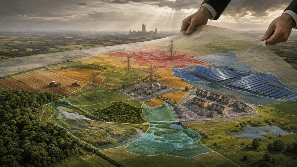
The secret selection of Britain’s energy future is only one part of a much larger transformation of our land.
Britain is not being replanned through one Bill or one openly debated national masterplan.
It is happening through a chain of laws, targets, strategies, maps, funding schemes and regulatory decisions.
Each is presented as a solution to a separate problem: climate change, nature loss, housing, energy, water, food security or economic growth.
But they are all making claims upon the same finite land.
The same field can now be assessed for food production, solar panels, pylons, woodland, flood storage, habitat creation, biodiversity credits or housing.
That is the issue. Not every policy is secret. Not every measure is legally binding. But the combined proposition has never been placed before the public or approved through one parliamentary vote.
The law fixes the destination
The machinery begins with the “Climate Change Act 2008 and its carbon budgets” (https://www.gov.uk/guidance/carbon-budgets).
The Act makes Net Zero by 2050 a legal duty. Its five-year carbon budgets limit total UK emissions and require governments to produce policies capable of meeting them.
Those limits reach into electricity, transport, heating, industry, farming and land management. The law fixes the destination. Successive delivery plans determine how every sector is expected to travel there.
The “Environment Act targets” (https://www.gov.uk/government/publications/environmental-improvement-plan-2025/environmental-improvement-plan-eip-2025) create a second pressure.
England must restore or create more than 500,000 hectares of wildlife-rich habitat outside protected sites by 2042. The revised Environmental Improvement Plan sets an interim target of 250,000 hectares by 2030 and a long-term target for tree canopy and woodland to cover at least 16.5 per cent of England by 2050.
These are not slogans. They require land.
The Land Use Framework draws the picture
England’s “Land Use Framework” (https://www.gov.uk/government/publications/land-use-framework/the-land-use-framework-for-england-accessible), published in March 2026, attempts to bring food, housing, energy, water, nature and climate pressures together.
Ministers insist that it does not tell owners what to do with their land and does not itself form part of planning policy.
That qualification matters.
But so does what comes next.
The Framework establishes a Defra Land Use Unit, promises the first single map of Defra’s national spatial priorities and says regional data will help inform the new Spatial Development Strategies.
Its modelling suggests that 480,000 hectares may undergo changes in agricultural practice while remaining mainly in food production.
A further 788,000 hectares may be used primarily for environmental and climate benefits. It projects 155,000 hectares for solar and onshore wind by 2050 and 168,000 hectares for urban expansion.
These figures must not simply be added together. Some uses overlap, some land remains partly productive and the renewable and housing figures are projections rather than allocations.
The Framework also concedes that energy land requirements beyond 2035 may exceed its current projection.
That is hardly a settled national land account.
30by30 turns ambition into a race for space
The Government’s “30by30 Delivery Plan” (https://www.gov.uk/government/publications/30by30-on-land-in-england-delivery-plan/30by30-on-land-delivery-plan) aims to have 30 per cent of land effectively conserved and managed for nature by 2030.
It does not mean that 30 per cent of England will automatically be seized, designated or removed from farming.
Only around 7 per cent currently meets the full “Gold” criteria. A further 3.5 per cent is anticipated to qualify, while about 9 per cent partly meets the standard. Government modelling identifies around 32 per cent of England as already likely, or potentially able, to contribute.
The importance lies in the direction of funding, management agreements and long-term protection.
Land can move from potential contribution to recognised 30by30 status through changed management, stronger protection and government or private support.
Local maps begin to influence real decisions
England’s 48 “Local Nature Recovery Strategies” (https://www.gov.uk/government/publications/local-nature-recovery-strategies/local-nature-recovery-strategies) cover the country without gaps or overlaps.
Each contains a habitat map and priorities showing where nature recovery would make the greatest contribution.
The maps do not compel a farmer to carry out a proposed action. Government guidance says there is no requirement for every mapped proposal to be delivered.
But public authorities must have regard to LNRSs. The “August 2026 National Planning Policy Framework” (https://assets.publishing.service.gov.uk/media/6a8334c03bd75b81e2329ac4/National_Planning_Policy_Framework.pdf) now requires development plans to use them when identifying environmental opportunities and steering development.
The NPPF also says mapped nature-recovery potential should not necessarily prevent development. Instead, it can be used to integrate development with environmental restoration.
That is an important distinction. An LNRS map is not a prohibition map. It is an influence map.
The influence becomes stronger when money follows it.
The “Farming Roadmap 2050” (https://www.gov.uk/government/publications/farming-roadmap-2050/farming-roadmap-2050-growing-englands-future-accessible-version) says Environmental Land Management spending will move towards a more spatial approach from 2027.
Some Sustainable Farming Incentive and Countryside Stewardship payments will be targeted towards places where government considers they will have the greatest impact. Landscape Recovery will also be spatially prioritised.
After 2030, some practices currently supported by public grants may move into regulation “where appropriate”. Private finance and environmental markets are expected to fund more routine activity.
The Roadmap itself says delivering nature and climate goals could require up to 9 per cent land-use change away from agricultural use.
This is how an advisory map can acquire practical force: through grants, regulation, planning weight and market prices.
Nature becomes a land market
Mandatory “Biodiversity Net Gain” (https://www.gov.uk/guidance/understanding-biodiversity-net-gain) requires most developments in England to produce at least a 10 per cent improvement in measured biodiversity value.
Where that cannot be achieved on site, developers can purchase off-site units. The habitat must normally be legally secured and managed for at least 30 years.
That creates a market in which farmland can be contracted to provide biodiversity units for development elsewhere.
Locations identified through LNRSs can receive greater value within the biodiversity metric because they are considered strategically important.
From 2 November 2026, a separate BNG regime will also apply to nationally significant infrastructure projects.
Energy planning completes the chain
The Strategic Spatial Energy Plan operates across Great Britain rather than England alone.
NESO’s “latest SSEP guidance” (https://www.neso.energy/document/385561/download) confirms that six alternative pathways are being compared in a confidential Pathway Options Report.
The Energy Secretary is due to select one pathway in autumn 2026, before the draft plan is put to public consultation.
The SSEP will identify broad zonal locations, technologies, capacities and timings for electricity and hydrogen generation and storage between 2030 and 2050. It will not choose individual solar farms, wind farms or substations.
But its consequences will travel downstream.
The selected pathway will feed the Centralised Strategic Network Plan and eleven Regional Energy Strategic Plans. “NESO’s current timetable” (https://www.neso.energy/news/neso-outlines-new-timelines-strategic-energy-plans) puts the final SSEP in autumn 2027 and the network and regional plans by the end of 2028.
These plans will determine the transmission and distribution infrastructure considered necessary to carry energy around the country.
The significance is written into the Government’s “Overarching National Policy Statement for Energy” (https://www.gov.uk/government/publications/overarching-national-policy-statement-for-energy-en-1-2025/overarching-national-policy-statement-for-energy-en-1-2025-accessible-webpage).
Where a transmission project has been assessed and justified through the CSNP, the Secretary of State will treat its need as established. Strategic choices such as overhead AC lines or offshore HVDC cables will not normally be examined again during the project’s consenting process.
The route can still be challenged. Its environmental effects must still be assessed. But the argument over whether the infrastructure is strategically needed may already be over.
The missing national decision
“Housing targets and New Towns” (https://www.gov.uk/government/consultations/new-towns-draft-programme), Spatial Development Strategies, “AI Growth Zones” (https://www.gov.uk/government/publications/delivering-ai-growth-zones/delivering-ai-growth-zones), industrial sites, reservoirs and “regional water planning” (https://www.gov.uk/government/publications/a-new-vision-for-water-white-paper/a-new-vision-for-water) must also fit onto this crowded map.
The “Nature Restoration Fund” (https://www.gov.uk/government/publications/nature-restoration-fund-implementation-plan/implementing-the-nature-restoration-fund) will allow some environmental obligations from development to be addressed through wider Environmental Delivery Plans rather than only through measures tied to the individual project.
Again, each policy has its own consultation and official justification.
What is missing is the complete picture.
Where is the reconciled national map showing energy, food, nature, housing, water, industry and infrastructure together?
Where is the regional assessment showing which communities will carry multiple burdens?
Where is the honest account of effects on farm viability, food output, imports, grid deliverability and consumer cost?
And where is the parliamentary vote approving the combined transformation?
This is not an argument against nature recovery or coherent infrastructure planning.
It is an argument against deciding the destination nationally, dividing the burden administratively and consulting communities only when the remaining question is how the chosen policy will be delivered locally.
By the time a farmer receives an offer, a pylon route appears or a solar project reaches consultation, the decisive national choices may already be embedded in targets, models, maps and funding rules.
Six secret energy futures are therefore only the beginning.
Britain’s countryside is being reshaped by an entire machinery of interlocking plans.
The British public should be allowed to see the whole map before government makes it real.
Shane Oxer — Campaigner for fairer and affordable energy
 SAY NO TO THE DESTRUCTION OF OUR LAND
Leave a comment